Overview
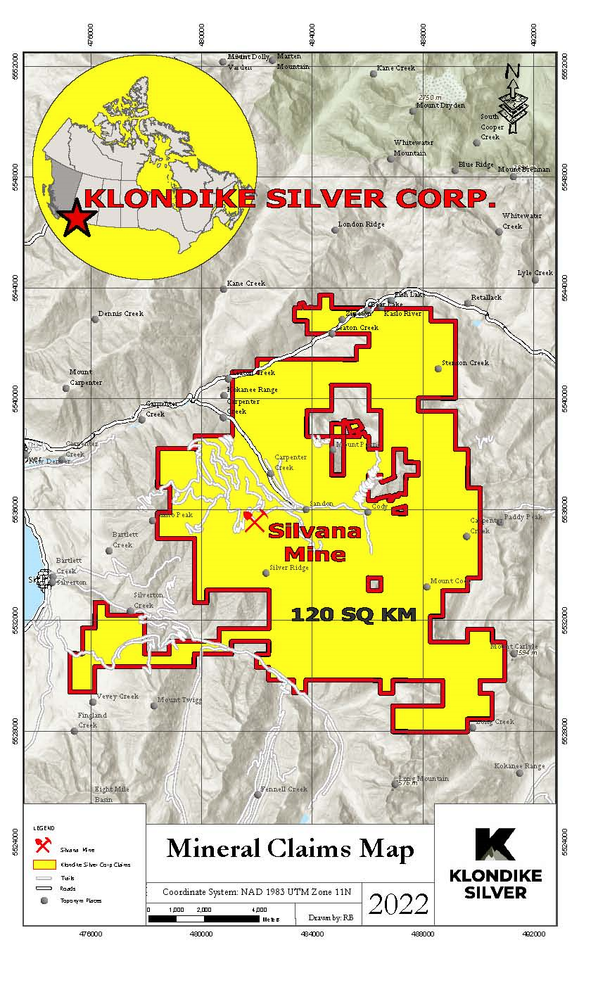
Klondike Silver’s 100%-owned Silvana Mine Project is a 114-square kilometre claim block in West Kootenay region of southeastern British Columbia, Canada. A series of silver-rich veins in Slocan Series Quartzite Sediments are located in Klondike's claim block. At 9 km long, the Main Lode is the largest and most prolific vein. Klondike Silver’s land package includes over half of the Main Lode structure and, of that, 1.5 km is virtually unexplored. Klondike's Slocan mining camp is one of the few remaining under-explored mining camps of its kind in Canada.
Within the claim block are multiple exploration target areas including: Jackson Basin, Payne, Sandon Camp, Silverton Creek, Cody Creek, and the Hewitt – Van Roi area.
Along with the permitted, 100-tonne-per-day flotation mill in historic Sandon, Klondike Silver's 114-square kilometre claim block includes the past-producing Silvana, Wonderful and Hinckley Mines, together with other past-producing mines and exploration properties. 68 of 173 past-producing mines are located on Klondike Silver’s Slocan land package. These 68 mines processed 2.1 million tons of ore, including silver 40.4 million ounces, lead 349 million pounds and zinc 159 million pounds.
The Silvana Mine was the largest of the 68 historical producers in the Klondike Silver land package: Over 500,000 tons of rock were processed yielding 7,812,077 oz silver, 63,253,498 pounds lead and 57,981,253 pounds zinc. The average Silvana production grade was 13.87 oz/ton silver, 5.62% lead and 5.15% zinc.
The Main Lode is an approximately nine-kilometre-long structure that hosted the biggest producing mines in the area. The Silver Mile is the most highly prospective segment of the Main Lode.
We are using advanced geophysical, geochemical and other modern exploration techniques to explore for extensions of known near-surface veins and new vein-hosted targets obscured by overburden.
Our 2021 work program involved continuing to upgrade the existing Silvana Mine Tailings Management Facility (TMF) at Sandon. We have engaged engineering and geotechnical firm, Tetra Tech, to work with us to examine, monitor and stabilize the TMF. In March 2021, Klondike Silver submitted to the Ministry of Energy Mines and Low Carbon Innovation the 2020 Dam Safety Inspection report, signed and sealed by a professional engineer. In April 2021, we completed an 11-hole drill program on the TMF designed to examine the embankments of all three tailings ponds, the tailing material within the ponds and the characteristics of the subsurface of the TMF. Tetra Tech installed piezometers in six of the 11 holes to measure the depth of the groundwater within the TMF. A Geotechnical Site Investigation and Erosion Protection Plan are being developed and implemented.
Off-site, we are continuing to develop the three-dimensional model of the deposit, based on previously-collected data and historic information. The 3D model will help to identify and prioritize future underground drill targets.
Maps
Site Location Map
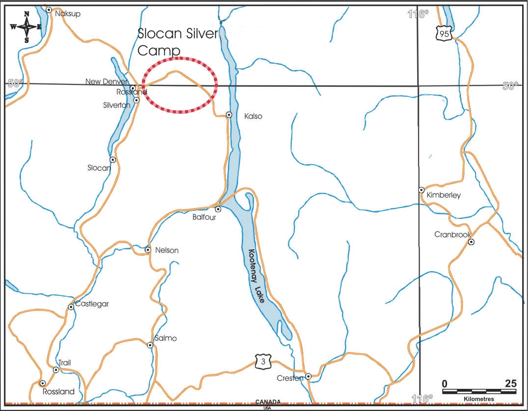
Regional Location Map